
High-Level Project Summary
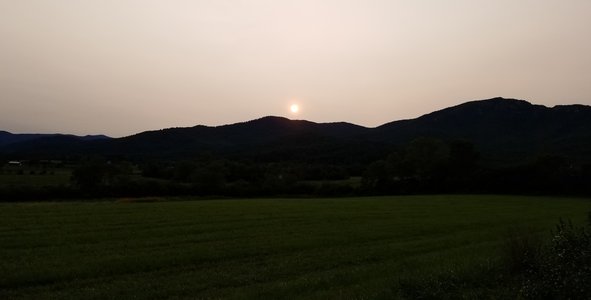
"540 Supercell" is a short film shot in and around the home of artist Daniel Bachman, in Banco Virginia. Glitched weather radar and footage taken during several extreme precipitation events flash wildly across the screen. Driving banjo and frogs, recorded in the mill race behind Bachman’s house, are easily overtaken by waves of hissing rain and hail. Electricity cuts out as the hard rain pounds against the metal roof and the river levels rise. "540 Supercell" attempts to recreate the emotional landscape of extreme weather within this localized context. A reality and rising concern in many communities up and down the Blue Ridge Mountains.
Link to Final Project
Link to Project "Demo"
Detailed Project Description
Weather is happening.
From the heart of Delhi, to Tangier Island. The burning redwood forests, the dying jet stream waters. It is happening to you and to me. We pump carbon dioxide and methane into the atmosphere by the gigaton as the cascading feedback loops of climate breakdown continue to destabilize the biosphere. Oh, the wind and rain. We have all lived it. Stunned by the unfathomable power of our Earth and a sinking derealization about our tenuous future.
"540 Supercell" lives in this space, and hopes to guide the viewer through a series of extreme precipitation events in and around the home of artist Daniel Bachman. The banjo is presented in a neutral modal tuning, avoiding conventional harmonic representations of mood and sentiment, and the sounds of the storms are often digitally altered in both subtle and obvious ways. At its core, "540 Supercell" is powered by the sounds of the Earth, tones inherently familiar to the billions of people who have experienced extreme weather. It is an attempt to emotionally contend with and foster connection over a shared global experience.

Space Agency Data
While the subject of this project was directly influenced through lived experience, the US Climate Resilience Toolkit, and especially the Climate Explorer app, were especially helpful in confirming aspects of our local weather patterns through hard data. For instance, residents of the counties surrounding Shenandoah National Park are observing hotter drier summers. This average temperature map of the Southeast Region of the United States confirms this.
Using the Climate Explorer app I was also able to access data from our local weather station in Sperryville Virginia (Station id: SPERRYVILLE Station: USC00447985) and learn that "Precipitation of 1 inch or more in a single day occurred 173 times between 1995-2022, which is an average of 6.41 per year." As well as "Precipitation of 0.01 inch or less in asingle day occurred 2,748 times between 1995-2022, which is an average of 101.78 per year." These are regional weather patterns that have been trending upwards over the last century.
This has also been observed anecdotally in the community, with documented evidence from a now deceased neighbor, stating, "For 63 years I have lived near the grain mill in Banco. During that time I have never seen flood waters rise within three feet of the first floor of the mill." Emily Thompson, Madison, VA. Sept. 11, 1980.

Hackathon Journey
I was very pleased to see this project mentioned by Peter Kalmus, as I would have no way of hearing about it otherwise. A lot of my work as an artist is centered around the impacts of colonialism and their effects on the climate crisis. I'm really happy to have learned of new resources related to the accessing of hard climate data. They are not so easily searchable through web browsers or for unaffiliated independent researchers. I look forward to incorporating them into my future work.
References
Some source video was licensed from storm chaser/nature photographer, Peter Forester, of Charlottesville, VA.
All other material/music was recorded and edited by Daniel Bachman.
Tags
Blue Ridge Mountains, weather, climate, climate breakdown, river, flood, Virginia