
High-Level Project Summary
"Şahin mobile app" is a new generation of AI-powered tracking systems that detects and plots groundwater location and their deepness. What make our project unique is the ability to easly interact with airborne data & see where exactly groundwater is located with accuracy and figure out either the water is salty or fresh . This concept will help people to save their time an money before thinking to digg a well for example. also to teach them about available resources in their location. how they are affected with climate changes. and how to save and deal with them.
Link to Final Project
Link to Project "Demo"
Detailed Project Description

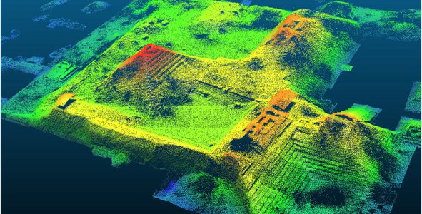
- Baically we take data from NASA's airborne companies about grounwater and plot them into a highly interactive map in a mobile application where user can see the location of groundwater resources. Their deepness and salinity. It will help the user to figure out if a specific location is able to digg a well in it or not. also it will apear to user the quantity and quality of groundwater in a way that will teach his how to deal with it and how to save it.
Space Agency Data
- Australian Space Agency
- we use data from AEM surveys and plot it into interactive virtual maps in out mobile application
Hackathon Journey
Well. we already had this idea before we started our journey in NasaSpaceApps Challnge. because here in Mrocco we souder a lot from this problem of water resources, but through the prgram we learned a lot about how to bring this idea to life by apliying Design4Dight consepts. and also we discovered the resources that NASA provides for scietific reasherch with is something new for us . something we didn't knew that it exists allready. so we started first with ideation and we did some modifications and updates about our projects; we also selected the future companies that might provides us with some usefull data to start working on the prototype.
References
- Airborne Electromagnetic survey for grounwater datection
Tags
#Water