Awards & Nominations
SpaceY has received the following awards and nominations. Way to go!
Global Nominee

SpaceY has received the following awards and nominations. Way to go!
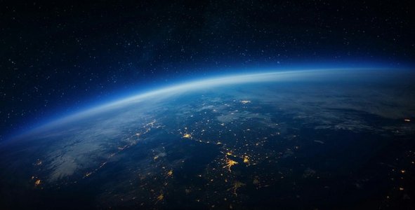
We believe in the power of data analytics. Throughout the intensive 48 hours of the hackathon, we developed both software and hardware (built a drone and Cube Satellite from zero.) Our solution SaaS in tact with the hardware supplements provide solutions to: 1) two of detect food crops at the early stages of getting infected by insects, and by using drones spread the necessary chemical supplements to mitigate the infection. finding the areas in need of plantation using Computer Vision detection algorithms. 2) Forecasting the risk and rise of tornadoes, tsunami, drought, floods, and sandstorms using predictive AI analytics on the basis of proven mathematical models.
Instructively, a Cube Satellite - as part of our hackathon work - is sent to the certain level in the atmosphere to gather the image and analyze it by the mathematical algorithms that we fed it with. Our analytics algorithms incorporated with the software help identify which crop area is at the stage of being infected or is already infected on the basis of specific anomaly criteria (notice that the same criteria can also be used in our Software as a paremeter for analyzing and forecasting earthquakes and volcano eruptions, yet that part of our algorithms and software feature are not complete at this moment due to the time limitations.)
The second application in detail of our SaaS is to accurately forecast tsunami, floods, tornado detection, and identify the major risks they may carry on the basis of our algorithms that identify particular patterns that spread and repeat across the data collection.
We used both high-level (for our software) and low-level programming languages (for our hardware) to build our solution.
Most importantly, we have also taken care of the commerical application of our solution which was inspired during the very hackathon. It is by our customer segmentation research as well as reaching out to few industry professionals via LinkedIn (during the hackathon) that the United Arab Emirates is one of the places where our SaaS can be implemented. Essentially, it is the government organizations, as well as small-scale business in the maritime and farming industry where we see a potential in our SaaS. Because it is not just the usage of external data and APIs, but the unique development of our solution concept, and the raise of our software architecture from zero, while keeping the business value in mind.
As part of the hackathon, our team was truly challenged to come up with a technically feasible solution while making sure that our SaaS meets all the necessary technical requirements of the hackathon. Apart from adding more than 2000 data sets to create the accurate model of the Earth map on our platform (which is currently live, and can be accessed via - http://challenge.robocontest.uz/ ), we took advantage of three NASA APIs to support and enrich our software with additional functionalities such as: land surface temperature, potential vegetation detection via light use, as well as net ecosystem CO2. We connected our source code to the mentioned NASA sources, that our team invested time in researching for, and these sources were significant feature additions that have a potential to be used by both small-scale and large-scale food farmers.
We asbolutely enjoyed in this hackathon.
To add, we were a team of six engineers (three undergraduates, two MSc students, and one doctoral student, all in the Computer Science program.)
We functioned pretty much like a startup, and used lean approaches to conceptualize, develop, and test both our software and hardware. Yet, it was still our previous experience in hackathons, and the previous experience of working with each other previously which enabled us to work on the hackathon challenge, and produce such an amount of work productively.
Land surface temperature: https://worldview.earthdata.nasa.gov/?v=-66.12246665511864,-47,137.86159708990127,53&l=Reference_Labels_15m(hidden),Reference_Features_15m(hidden),Coastlines_15m,MODIS_Aqua_Land_Surface_Temp_Day,MODIS_Terra_CorrectedReflectance_TrueColor&lg=false&t=2002-07-04-T00%3A00%3A00Z
Percent of Potential Vegetation Light Use Efficiency: https://worldview.earthdata.nasa.gov/?v=-66.12246665511864,-47,137.86159708990127,53&l=Reference_Labels_15m(hidden),Reference_Features_15m(hidden),Coastlines_15m,SMAP_L4_Emult_Average,MODIS_Terra_CorrectedReflectance_TrueColor&lg=false&t=2015-04-14-T00%3A00%3A00Z
Net ecosystem CO2 exchange: https://worldview.earthdata.nasa.gov/?v=-66.12246665511864,-47,137.86159708990127,53&l=Reference_Labels_15m(hidden),Reference_Features_15m(hidden),Coastlines_15m,SMAP_L4_Mean_Net_Ecosystem_Exchange,MODIS_Terra_CorrectedReflectance_TrueColor&lg=false&t=2015-04-14-T00%3A00%3A00Z
References: SPL4CMDL doi:10.5067/L6C9EY1O8VIC
(Can be accessed from the provided GitHub link.)
The software and hardware were initially tested on functionality (successful), and physically presented before the judges of Uzbekistan, You can access the hardware pictures from the provided presentation slides.

(SpaceY team member building the drone.)

(SpaceY team member building the hardware of the Cube Satellite (conceptually the top side is to be a solar panel to be energy sustainable once launched to its orbit). Raspberry and the mini-sensors installed inside for the data exchange, and storing collected data at times of Internet disconnection on air.)
#earth #datasolution #climatechange #food #crops #nasamaps