Awards & Nominations
SARchasm has received the following awards and nominations. Way to go!


SARchasm has received the following awards and nominations. Way to go!
Our project, SARchasm, is an open source notebook that guides the user in extracting an InSAR graph without tropospheric interferences. The notebook uses valid data repositories and scientific tools in order to build an InSAR graph, correct it in terms of the tropospheric interferences, and returns the new, corrected InSAR graph. Our idea comes to answer the lack of open source software for the creation of corrected InSAR graphs. We came up with a solution, based on a mathematical model, that is open source and allows each user, of any level and field, to generate, correct and study InSAR graphs, without using exclusive software or difficult to find data.
SARchasm is a notebook that we developed during the NASA Space Apps challenge of 2022, while tackling the challenge "Insar Change Detectives". The purpose of this Notebook is to guide the user on the process of creating wrapped and unwrapped interferograms and, in the implementation of our code for cleaning tropospheric vapor interference from UnWrapped InSAR interferograms. Simply put, this contains:
In it's first part, the notebook contains instructions for the creation of an Unwrapped Interferometric graph, in a form that can be used by our software for atmospheric corrections. The instructions include a step by step guide in using SNAP so that anybody can just pick up a laptop after some time, end up with a high accuracy unwrapped interferogram, to use as their application demands. The benefits of part one include the increase of data access to everyone, as the value of information is directly proportional to their accessibility.
Following part 1 of this notebook allows anybody with access to a computer to be able to assess the altitude change and ground movements of any place on earth over their desired period of time. It gives the user a new power that could previously be obtained solely by spending a long time studying SAR, InSAR, big datasets and so on. The ingenuity of part 1 of this project comes from the fact that there simply isn’t such a short and efficient summary of the necessary information to execute these tasks. We hope to prove to anyone that they can achieve working specialized tools, however complex it may seem, to get the necessary information.
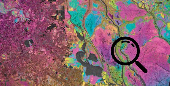
In it’s second part, the notebook contains a code developed by the team that corrects the InSAR graphs in terms of the tropospheric interferences, and returns the new, corrected graphs. Few inputs are needed by the user, that can be found easily in data repositories that are linked in the notebook. The code loads the initial graph, provided by the user, and the rest of the input parameters, and subtracts the delays caused by the troposphere. Then, the corrected graph is generated.
For each InSAR, the tropospheric delays are represented by the value ZTD (Zenith Tropospheric Delay), which is the sum of hydrostatic and wet delay components. The ZTD is calculated for each pixel of the input InSAR by the combination of formulas that link the ZTD with the atmospheric characteristics of the area and the behaviour of the radar signal in it. The ZTD for each pixel are calculated in regard to the corner pixels, using the Inverse Distance Weight Logic, which indicates that the value of a point is determined by the values of the surrounding point, multiplied by a factor of weight, which is determined by the distance of the reference point and the points with known values.
Our idea comes to answer the lack of open source software for the creation of corrected InSAR graphs. Such software are limited to professional scientists, or can be bought by the audience at a high price. We came up with a solution, that is open source and allows each user, of any level, e.g. students, professionals, the public etc., to generate, correct and study InSAR graphs, without using exclusive software or difficult to find data.
In addition, our code is based on a mathematical model for the calculation of the tropospheric interferences, thus being able to calculate the correction for any place, in any date, using easy to find data. Our method is based on valid scientific papers and combines their methodologies in order to achieve the best and more accurate result.
The following tools were used: SNAP, Snaphu, python, MATLAB, Google Collab.
NASA resources and specifically the open data provided to us by the Sentinel-1 Dataset were highly useful to us and the exploration of the various datasets proved to be fruitful. We used this dataset to extract SAR images of various places and then compute the interferograms we used. The earthquake and volcanic eruption data were used as inspiration for the form an interferogram shall have at a preliminary level. To ensure the scientific validity of our approach, many papers were accessed as resources. We cite “Generation of real-time mode high-resolution water vapor fields from GPS observations, Yu et al., 2021” and “Calculation of Zenith Delays From Meteorological Data Comparison-of NWP Model, Radiosonde and GPS Delays, Vedel et.al, 2001” as the main inspirations for our algorithm construction. For our temperature, pressure and humidity measurements the https://www.ventusky.com site was incorporated as a reliable and multi-information source on data from any location at any given time period.
During our time at the global event and having not participated in a live event before (but only virtually), we researched intensively, discussed various aspects of the project and had fun together as a team. We also broadened our minds and learned about a new topic, INSAR data processing and error corrections.
-Fields from GPS observations, Yu et al., 2021
-Calculation of Zenith Delays From Meteorological Data Comparison-of NWP Model, Radiosonde and GPS Delays, Vedel et.al, 2001
-Journal of Geophysical Research: Atmospheres
-Atmospheric effects in interferometric synthetic aperture radar surface deformation and topographic maps
-Atmospheric Effects on InSAR Measurements and Their Mitigation
-ATMOSPHERIC WATER VAPOUR DETERMINATION BY THE INTEGRATION OF INSAR AND GNSS OBSERVATIONS
-High-Resolution Water Vapor Mapping from Interferometric Radar Measurements
-Imaging from Spaceborne and Airborne SARs, Calibration, and Applications - Masanobu Shimada
-THE SAR HANDBOOK Comprehensive Methodologies for Forest Monitoring and Biomass Estimation DOI: 10.25966/nr2c-s697
#errorcorrection #imaging #sentinel1 #geological #insar #sar #algorithm
Earth scientists would like to use radar signals to observe small deformations of Earth’s surface, but interactions with tropospheric water vapor slow down the radar signal and make it look like the ground is moving. Your challenge is to come up with an algorithm to remove the tropospheric signal from various radar datasets and discern the real ground motion!