
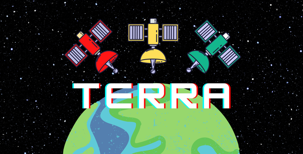
High-Level Project Summary
“ObsEarth” is not only an educational but also an entertaining website. It aims to increase its user's knowledge of NASA's past and future missions of Earth observation in the most efficient way. “ObsEarth” includes an interactive timeline, mini-games, and 3D satellite designing tutorials. First, the users learn the topic with the timeline, then test what they've learned with the trivia, play the memory game or design 3D satellites with the tutorial videos. “ObsEarth” also draws attention to the importance of Earth observation. Acknowledging our planet is the first step to understanding our universe. “ObsEarth” will make this process of learning fun and comes in handy with all users.
Link to Final Project
Link to Project "Demo"
Detailed Project Description
Our project organizes the information we collected from authorized websites and brings it together into one website: “ObsEarth”. This website is a savior of time for our users because with “ObsEarth” it is not necessary to search all over the Internet to find a set of information, games, quizzes, and design tutorials about NASA’s Earth Observing Missions. “ObsEarth” also makes learning fun and interesting with the help of its design and contents.
 "ObsEarth” is a website specifically designed to understand and learn NASA’s history of Earth Observing Missions. However, “ObsEarth” is more than just a learning platform. It includes a timeline of the journey of NASA’s satellites that are designed to observe the Earth for its topography, humidity, weather conditions, etc. With the assistance of the timeline we created with the information based on NASA's original website, people can see the satellites’ development closely and learn what happened when. Timelines provide efficient learning by making relations with the present and the past. At the end of our timeline, we put a link to "NASA’s Eyes on the Earth website" for those who want to see where satellites are right now and what they are observing at this moment.
 In order to provide an educative and also a fun platform, we added a memory game that expedites the memorizing of what Earth Observing Satellites look like. When the picture is matched with its identical one the name of that satellite shows up. And people can make use of the timer above the game and challenge themselves and others to finish the game faster.
 Afterward, people can have a look at our trivia called “E.T.(Earth Trivia)” and test their knowledge or repeat what they have learned to have better and permanent learning. “E.T.(Earth Trivia)” has questions that are enriched with images so you can use both information you’ve learned from the timeline and the memory game. Both of these games have QR codes for users to access them easily.

There is also a Watch&Design part where people can watch the process of designing a satellite from TinkerCad. After beholding the videos, everyone will be able to create a 3D design of a satellite of their own choice. Last but not least, people can contact us from the Contact part if they have something on their mind whether a question or feedback.

Including NASA's original website, there are other websites that contain information about NASA's Earth Observing Missions. The questions "What is ObsEarth's difference? How does it stand out from the others?" may come to mind. First of all, during the research process, we noticed that the existing websites listed information in long paragraphs that might not attract readers' attention. Therefore, we only used important details and made them look appealing to users. We also simplified the terms and used a language that anyone can understand. The games we created provide more efficient learning and qualified entertainment. Lastly, via the QR Codes and links, we used our users can have access to correct information quickly.
Since we've designed a website there are many opportunities for us to evaluate. Currently, ObsEarth is only available in English, but it can be translated to other languages for the use of people from all over the world. Also, by reaching an agreement with experts, our website can ensure online lessons and seminars about the topics people are most curious about. These are the ways how our website can be developed.
With“ObsEarth” we are hoping to inspire everyone to learn more about NASA, satellites, and NASA’s Earth Observing Missions. We think it’s important to know not only what happens on Earth but also what happens around it. Satellites of all kinds but especially Earth Observing Satellites have huge effects on our lives and we think everyone should be aware of it.
We created our website using the help of Wix.com. For our design tutorials, we used Tinkercad.com, and with Interacty.me we created our timeline, memory game, and trivia.
Space Agency Data
NASA:
NASA, short for National Aeronautics and Space Administration, is an independent agency of the US government. It was founded by Dwight Eisenhower (The US President) on October 1st, 1958. NASA was established succeeding the NACA(National Advisory Committee for Aeronautics). The competition we participated in was arranged by NASA itself. The websites that NASA created helped us get informed about the satellites we used on our website. NASA had created websites about satellites that observe specific subjects. Our challenge includes researching NASA's Earth-observing missions. NASA's informative website which is about satellites inspired us to create a fun and teaching timeline.
ESA:
ESA, short for European Space Agency, is an international space agency that was established in 1975 by European scientists. For the time being, it has 22 members. During the data acquisition part of our project, we have come across a few mutual satellites of ESA and NASA. Copernicus Sentinel-6 Micheal Freilich is the one we used on our timeline.
JAXA:
Japan Aerospace Exploration Agency, was formed by merging three previous space agencies on October 1st, 2003 in Tokyo, Japan. JAXA surveys technology development and launch of satellites into orbit. From time to time, NASA has worked with JAXA too. GPM satellite, which we used to create our timeline, is a shared work of NASA and JAXA. The Global Precipitation Measurement (GPM) Core Observatory is a joint Earth-observing mission between NASA and the Japan Aerospace Exploration Agency
Hackathon Journey
As Team TERRA members, none of us has ever joined a hackathon. We tried to imagine how it would be, would we have fun... And at the end of this journey, we can truly say that it is much more than we could ever dream of.
Before this event, if you had asked me which satellite took the first photo of Earth, I would have had no idea. But now, I can say the answer is Explorer 6 with confidence. We've learned so much just in a short time and it really broadened our minds. We can give you any information about Earth Observing Satellites, their launch details, and the data they've collected. I would also like to add that we had so much fun while hacking and built strong bonds as a team.
We were all interested in this topic but didn't know much about it. Therefore we wanted to learn more about satellites and decided on the Nimbus to Now challenge. During the process of gathering information from various websites, we noticed that these sites might not attract everyone's attention. This inspired us to create an educative and entertaining platform.
We faced some minor setbacks such as finding the right sites and articles to do the research from and finding non copyrighted pictures. But eventually, after some research, we overcame these obstacles.
In other words, the last two days included an experience of a lifetime. It was a magical journey. We would like to thank NASA for arranging this event and our local hosts (ODTÜ Genç Girişimciler Topluluğu) for providing us with a comfortable workplace and making this experience better in any way.
References
- https://science.nasa.gov/missions-page?field_division_tid=103&field_phase_tid=All
- https://swot.jpl.nasa.gov/applications/overview/
- https://www.jpl.nasa.gov/missions/surface-water-and-ocean-topography-swot
- https://en.wikipedia.org/wiki/Tropospheric_Emissions:_Monitoring_of_Pollution
- https://weather.msfc.nasa.gov/tempo/
- https://www.jpl.nasa.gov/missions/active-cavity-irradiance-monitor-satellite-acrimsat
- https://en.wikipedia.org/wiki/Surface_Water_and_Ocean_Topography
- https://swot.jpl.nasa.gov/mission/overview/
- http://tempo.si.edu/overview.html
- https://science.nasa.gov/missions-page
- https://gpm.nasa.gov/missions
- https://en.wikipedia.org/wiki/Global_Precipitation_Measurement
- https://gpm.nasa.gov/missions/GPM
- https://gpm.nasa.gov/missions/trmm
- https://eospso.nasa.gov/current-missions
- https://www.nasa.gov/content/goddard/taking-nasa-usgs-s-landsat-8-to-the-beach/
- https://www.usgs.gov/landsat-missions/landsat-8
- https://www.satimagingcorp.com/gallery/landsat-8/
- https://earth.esa.int/eogateway/missions/landsat
- https://landsat.gsfc.nasa.gov/about/landsat-timeline/
- https://en.wikipedia.org/wiki/CALIPSO
- https://en.wikipedia.org/wiki/CloudSat
- https://cloudsat.atmos.colostate.edu/news/Hurricane_Laura
- https://www.nasa.gov/feature/langley/sister-satellites-briefly-separated-working-together-again
- https://www.nasa.gov/feature/jpl/cloudsat-exits-the-a-train
- https://www.nasa.gov/mission_pages/cloudsat/main/index.html
- https://www-calipso.larc.nasa.gov/
- https://science.jpl.nasa.gov/projects/calipso/
- https://www.nasa.gov/feature/goddard/2020/nasa-s-calipso-satellite-animation-shows-smoke-from-australian-fires-spreading-high-and-far
- https://aqua.nasa.gov/
- https://en.wikipedia.org/wiki/Aura_(satellite)
- https://aura.gsfc.nasa.gov/about.html
- https://nssdc.gsfc.nasa.gov/nmc/spacecraft/display.action?id=1959-004A
- https://svs.gsfc.nasa.gov/4339
- https://www.nasa.gov/mission_pages/Grace/overview/index.html
- https://eospso.nasa.gov/missions/ice-cloud-and-land-elevation-satellite
- https://www.nasa.gov/mission_pages/icesat/icesat-end.html
- https://nasa3d.arc.nasa.gov/detail/ICESat-2
- https://nssdc.gsfc.nasa.gov/nmc/spacecraft/display.action?id=1964-052A
- https://disc.gsfc.nasa.gov/information/news?title=Nimbus%201%20HRIR%20heritage%20data%20set%20archived%20at%20the%20NASA%20GES%20DISC
- https://www.usgs.gov/landsat-missions/landsat-7
- https://landsat.gsfc.nasa.gov/satellites/landsat-7/
- https://nssdc.gsfc.nasa.gov/nmc/spacecraft/display.action?id=1959-004A
- https://science.nasa.gov/missions/tiros
- https://nssdc.gsfc.nasa.gov/nmc/spacecraft/display.action?id=1964-052A
- https://www.usgs.gov/landsat-missions/landsat-7
- https://terra.nasa.gov/about/mission
- https://www.nasa.gov/mission_pages/terra/spacecraft/index.html
- https://www.jpl.nasa.gov/missions/orbiting-carbon-observatory-2-oco-2
- https://www.nasa.gov/smap
- https://www.nasa.gov/smap/overview
- https://smap.jpl.nasa.gov/observatory/overview/
- https://icesat-2.gsfc.nasa.gov/
- https://sentinels.copernicus.eu/web/sentinel/missions/sentinel-6
- https://www.jpl.nasa.gov/missions/sentinel-6
- https://sentinel.esa.int/web/sentinel/news/video/-/asset_publisher/
- https://tr.wikipedia.org/wiki/Dosya:Explorer_6_paddles_up.jpg
- https://tr.wikipedia.org/wiki/Dosya:TIROS-1_image.jpg
- https://eospso.nasa.gov/sites/default/files/sat/Landsat7_b.jpg
- https://eospso.nasa.gov/sites/default/files/sat/Nimbus-1.jpg
- https://en.wikipedia.org/wiki/ICESat#/media/File:Icesat.jpg
- https://en.wikipedia.org/wiki/Orbiting_Carbon_Observatory_2#/media/File:Orbiting_Carbon_Observatory-2_artist_rendering_(PIA18374).jpg
- https://en.wikipedia.org/wiki/Sentinel-6_Michael_Freilich#/media/File:Sentinel-6_Michael_Freilich_(2).jpg
- https://en.wikipedia.org/wiki/Soil_Moisture_Active_Passive#/media/File:Soil_Moisture_Active_Passive_illustration_(15-180,_cropped).jpg
- https://www.canva.com
- https://tr.wix.com
- https://interacty.me
- https://www.tinkercad.com/
.jpg)
.jpg)
.jpg)
Tags
#website, #earth, #satellites, #earthobserving, #nasa, #observation, #games, #timeline, #spaceapps